 |
 |
|
 |
 |
 |
Spatial Analysis & Classification Research
 Ecosystem classification and mapping provide a concise overview of the spatial and volumetric structure of landscapes that can be used to support analysis and modeling of ecosystem processes and decisions about where various management approaches ought to be implemented. Research in this field covers a wide array of topics, ranging from analyzing the accuracy of remote sensing, classifying landscapes according to ecosystem classifications, and conducting inventories of natural resources and ecosystems. Some of the current Spatial Analysis & Ecosystem Classification Research Projects at SNRE include:
Landscape Ecosystems of the University of Michigan Biological Station (Burton Barnes) Ecosystem classification and mapping provide a concise overview of the spatial and volumetric structure of landscapes that can be used to support analysis and modeling of ecosystem processes and decisions about where various management approaches ought to be implemented. Research in this field covers a wide array of topics, ranging from analyzing the accuracy of remote sensing, classifying landscapes according to ecosystem classifications, and conducting inventories of natural resources and ecosystems. Some of the current Spatial Analysis & Ecosystem Classification Research Projects at SNRE include:
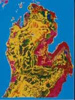
Landscape Ecosystems of the University of Michigan Biological Station (Burton Barnes)
Upland and wetland landscape ecosystems, cover types, and land forms were distinguished, classified, and mapped for the 4000 hectare University of Michigan Biological Station (UMBS). Diversity of landscape ecosystems was compared quantitatively for several major and minor landforms of UMBS and with other areas of Michigan. Groundflora diversity within and among ecosystems and landforms was also determined. The landscape ecosystem approach provides the baseline for monitoring changes in the diversity of plants and animals due to climatic change. <return to top>
Landscape Pattern and Ecological Process at Alpine Treeline (Dan Brown)
This work in Glacier National Park, Montana explores the relations between pattern and process by using spatially explicit simulation models and comparing the two dimensional patterns that we simulate with observed two dimensional patterns of alpine treeline. We use patterns recorded by Landsat TM and airborne multispectral scanner imagery as our observations and compare several spatial metrics which have been used to assess the nature and degree of spatial organization of landscapes based upon different pattern descriptors. We assess the sensitivity of alpine tundra to invasion by woody species from treeline in the northern Rocky Mountain region. The results allow the interpretation of past and ongoing changes at and above treeline in the wildlands of the western US. <return to top>
Land-Use and Land-Cover Change in the Upper Midwest (Dan Brown and Kathleen Bergen)
This project examines changes in land cover patterns as a function of socioeconomic changes, dispersed development, and subsequent changes in the spatial patterns of land ownership in the Upper Midwest (defined to include forested regions of Michigan, Minnesota, and Wisconsin). Spatial patterns of land ownership (i.e., parcelsize and pattern) and their trajectories through time provide a critical link in understanding the environmental implications (i.e., LCLUC) of societal and economic factors. We are also generating land-cover change data for the seven-state North Central region (Illinois, Indiana, Iowa, Michigan, Minnesota, Missouri and Wisconsin) in support of the Hot Spots of Landscape Change Project of the North Central Research Station (USDA-Forest Service). The basic objective is to use a national land-cover classification from 1980 (USGS LUDA) combined with AVHRR satellite imagery from 2000 and identify areas within which substantial changes have occurred. We will develop a method to make these datasets comparable and will perform a validation of the results through use of a sample of classified NAPP photos and Natural Resources Inventory (NRI) land-cover statistical data. <return to top>
Michigan River Inventory (Michael Wiley)
The Michigan River Inventory (MRI) is a long-term collaborative research project with the Institute of Fisheries Research within the Michigan Department of Natural Resources (MDNR). It focuses on the development of a large regional database for studying the large scale ecology of Michigan's rivers. The MRI database includes site and catchment-level data for 675 study sites which are linked to an extensive geographic information system (GIS). This combination of a GIs and extensive field inventory database was designed to both describe and model key features of the biology, hydrology, and water quality of the major river systems in Michigan's lower peninsula. Work begun under this project has evolved in several directions and has generated other funded projects which use these basic data for different management purposes, including (1) Ecological Classification of Michigan Rivers: This project is part of a larger effort to provide a prototype ecosystem classification for MDNR management activities. The main task is the development of a system for stream classification that is compatible with the LTA (Land Type Association) classification being developed for the state by ecologists at the Natural Features Inventory; and (2) Ecological Valley Segment Classification (VSEC) for River Conservation: This collaboration between the project above and The Nature Conservancy, began in fall 1996. The project evolved from the Conservancy's interest in using the MRI-VSEC approach in a prototype for nationwide stream classification. Their goal is to use classification to identify river segments for conservation and acquisition. This effort could lead directly to the preservation of rare or important riverine environments, and is an opportunity to develop tools that will have national, and later international, conservation applications. <return to top>
Regional Landscape Ecosystems of Michigan (Burton Barnes)
Quantitative studies of climate and detailed studies of geology, physiology, and soil were integrated to describe and map the regional landscape ecosystems of Michigan.<return to top>
Relationship between Ecosystems and Scenic Management: Assessing Constituents' Perceptions and Preferences of Forest Landscapes (Rachel Kaplan, Terry Brown, and Gary Purdum)
This project examines some of the potential dilemmas created by different classification systems. For example, the Ecological Classification and Inventory (ECI) System and the Scenic Management System (SMS) are currently both used by the Forest Service. Each system addresses vital management issues. Whether information collected by one system is useful to the other has not been addressed. Nor is it known how these professionally-based classification systems are related to the public's intuitive categorizations. Differences between the systems relate to both scale and purpose. For example, the scale of units that guide ecosystem and wildlife management may be too large for addressing the management of the visual resource. It is also possible that the appropriate unit of analysis differs depending on the ecosystem. With respect to purpose, it is likely that ecosystem management would rely upon expert decisions, while what constitutes scenic quality is often considered to include a subjective component. Thus, in addition to perceptual issues, scenic management raises issues of what is more scenic. The purpose of the study is to explore the relationship of public visual preferences and forest landscape ecosystems.<return to top>
Spatial Analysis Society-Ecosystem Interactions in Southeastern Michigan (Multidisciplinary Team)
A number of projects use spatial analysis in support of analyzing interactions between human activity, land use patterns, and the diversity and function of terrestrial and aquatic ecosystems in Southeastern Michigan. Work on this project involves mapping historical land use and land cover patterns within this rapidly urbanizing region, evaluating spatial patterns of land cover evolution in response to land use demands, and developing spatial decision support systems for watershed and ecosystem planning. <return to top>
Related EMI Spatial Analysis & Ecosystem Classification Links
|
 |
 |