Introduction to the Study
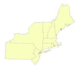
This study explores the development and implementation of the Comprehensive Wildlife Conservation Strategies, also known as State Wildlife Action Plans (plans), for the nine Northeastern states of Connecticut, Maine, Massachusetts, New Jersey, New York, New Hampshire, Pennsylvania, Rhode Island, and Vermont. As part of a study funded by the National Council for Science and the Environment’s Wildlife Habitat Policy Research Program, eight universities conducted research on development and implementation of all U.S. plans. For more information on the national study, please visit the Initial Implementation of U.S. State Wildlife Action Plans homepage.
During 2007–2008, a team of nine interdisciplinary graduate students at the University of Michigan School of Natural Resources and Environment investigated plan development and implementation in nine states in the Northeast United States. The team’s findings of state wildlife conservation activities, emerging conservation priorities, new conservation approaches and tools, and examples of current projects that demonstrate promising directions for accelerating habitat conservation are available in various publications on this website. They can be accessed using the menu at the left, or on our Publications page.
Background on the Northeast Region
The U.S. Census Bureau defines the Northeast region as the New England states of Maine, New Hampshire, Vermont, Massachusetts, Connecticut, and Rhode Island, and the Middle Atlantic states of New York, New Jersey and Pennsylvania. In 2006, the region’s urban, suburban and rural communities supported 54.6 million people. The dense band of urban and suburban communities from Boston south to Washington D.C. is the nation’s largest megapolitan region, and also continues to experience faster than average growth. The total percentage of development in the Northeast is far greater than the national average, while at the same time, the region has the least federally owned land across the nation and the most privately held property.
The Northeast is the most densely populated region of the country. New Jersey and Rhode Island, the first and second most densely populated states, each support more than 1,025 residents per square mile – more than three times the average population density of India. Six of the region’s nine states are among the ten most densely populated in the nation. Despite a history of compact development in the region, recent development trends are leading to increases in per capita acreage development. For example, from 1950 to 2000, Massachusetts' population increased 28%, but the area of developed land increased 200%. While human impacts on wildlife are traditionally associated with urban development, suburban and exurban sprawl has increasingly become a conservation concern.
The Northeast United States is home to diverse natural landscapes, including thousands of miles of rivers and rugged coastline and millions of acres of mountains, forests, and grasslands. More than 1,300 vertebrate species depend on ecosystems across the region for their survival. As forests, wetlands, and agricultural lands are developed with roads and buildings, wildlife species face shrinking and fragmented habitat. This loss of open space escalates the impact of other wildlife threats such as nonpoint source pollution and climate change. Not surprisingly, all nine Northeastern fish and wildlife agencies report that many of their most significant conservation challenges stem from habitat loss, fragmentation from development and transportation infrastructure, and direct and indirect destruction of wildlife habitat.