
Image

 back to all news
For the second year in a row, researchers are forecasting a smaller than average Chesapeake Bay “dead zone” due to reduced river flows and less nutrient and sediment pollution.
The annual forecast was announced today by scientists at the University of Michigan, the Chesapeake Bay Program, the University of Maryland Center for Environmental Science, and the U.S. Geological Survey. They also credited management actions taken across the watershed to improve water quality.
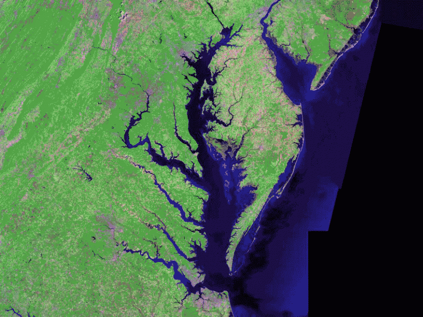
The bay’s hypoxic and anoxic regions, which are areas of low and no oxygen, respectively, are caused by excess nutrient pollution. Compared to the last 35 years, this year’s Chesapeake Bay hypoxic volume, or dead zone, is predicted to be 14% lower than average, while the volume of water with no oxygen is predicted to be 18% lower than average.
“While this year’s forecast is smaller than the long-term average, the long-term average is not the goal,” said University of Michigan aquatic ecologist Don Scavia, a member of the research team.
“The forecast is still larger than that implied by the targets set under the Chesapeake Bay Total Maximum Daily Load, implying that enhanced management actions are still needed,” said Scavia, a professor emeritus at the School for Environment and Sustainability.
The levels of pollution reaching the Chesapeake Bay each year vary with the amount of spring rainfall, which impacts river flows. Additionally, efforts by Chesapeake Bay Program partners are gradually reducing the amount of nutrient and sediment pollution entering those rivers and the bay.
“This year’s forecast suggests a smaller dead zone than is typical because the river flows that carry nutrients to the bay were slightly lower than normal. But the amount of nutrients carried to the bay by a given amount of flow has lessened over time due to effective nutrient management in the watershed. This is an example of a positive trajectory for the bay,” said Jeremy Testa of the University of Maryland Center for Environmental Science.
Though different types of nutrients contribute to the annual dead zone, the amount of nitrogen that enters the bay from January through May is a key driver in how hypoxic conditions can vary from year to year. The U.S. Geological Survey monitors river flow, nutrients and sediment entering the bay at nine river input monitoring stations.
In spring 2021, those stations showed that the Chesapeake received 19% less nitrogen pollution when compared to the long-term average. Nitrogen loads entering the bay included an estimated 98 million pounds recorded at the monitoring stations and an additional 6.6 million pounds from treated wastewater discharge and non-point sources (e.g., agricultural, stormwater and urban runoff) located downstream of those stations.
The Maryland Department of Natural Resources and Virginia Department of Environmental Quality conduct eight to 10 cruises between May and October to track summer hypoxia in the bay. A bay-wide assessment of the 2021 dead zone will be available this fall.
“Less hypoxia is important as it means better habitat for our iconic bay species, such as crabs, oysters and striped bass,” said Tom Parham, director of Tidewater Ecosystem Assessment at the Maryland Department of Natural Resources.
A model developed by the University of Michigan has been used since 2007 to forecast the volume of summer hypoxia in the main stem of the Chesapeake based on the amount of nitrogen pollution flowing into the bay from the Susquehanna River from the previous January through May. This year’s forecast is based on a revised and updated model that accounts for nitrogen entering the bay from the nine river monitoring stations and the wastewater treatment plants downstream of them.
A companion model from the University of Maryland Center for Environmental Science forecasts summer volumes of oxygen-free water. Funding for the models has come from the National Oceanic and Atmospheric Administration. Data used by the models are provided by the U.S. Geological Survey, Maryland Department of Natural Resources, Virginia Department of Environmental Quality and Chesapeake Bay Program.
The dead zone is an area of little to no oxygen that forms when excess nutrients, including both nitrogen and phosphorus, enter the water through polluted runoff and feed naturally occurring algae. This drives the growth of algae blooms, which eventually die and decompose, removing oxygen from the surrounding waters faster than it can be replenished. This creates low-oxygen, or hypoxic, conditions. Plant and animal life are often unable to survive in this environment, which is why the area is sometimes referred to as a dead zone.
Last year, the Virginia Institute of Marine Science reported that the 2020 dead zone was smaller than 80% of those monitored since 1985.
Written by Rachel Felver of the Chesapeake Bay Program.