
Utility

  • Admissions
  • Exploring Grad School
  • Current Students
  • Diversity, Equity & Inclusion
  • Faculty + Staff
  • Alumni
Give
COVID-19 UPDATES
Report Sexual Misconduct
Home

Main navigation

Search is currently disabled
  • Academics
    • Master of Science
    • Master of Landscape Architecture
    • Doctoral (PhD)
    • Dual-Degree Programs
    • Graduate Certificate Programs
    • Undergraduate Program
    • Courses
  • Research + Impact
    • Sustainability Themes
    • PhD Profiles
    • Student Research
    • The Centers, Institutes + Initiatives
    • Faculty Profiles
    • Labs
  • Admissions
    • Exploring Graduate School
    • Why Michigan?
    • How to Apply
    • Funding
    • Online Games
    • Visit Campus
    • International Students
    • For Admitted Students
    • Admissions FAQs
    • Rackham Graduate School Resources
  • Student Services
    • SEAS Student Center
    • Career Services
    • Financial Aid
    • Academic Advising
    • Student Organizations
    • Student Development
    • Forms, Handbooks + Policies
    • Quick Links
  • News
    • Community Highlights
    • In the Media
    • Stewards Magazine
  • Events
    • Co-Sponsorship Form
    • Submit Event
    • Admissions Webinars
    • Gallery
  • About
    • Who We Are
    • Leadership
    • Demographics
    • Faculty Profiles
    • Administrative Departments + Staff
    • Facilities + Locations
    • Diversity, Equity + Inclusion
    • Art & Environment Gallery
    • Land Acknowledgement
    • History

Utility

  • Admissions
  • Exploring Grad School
  • Current Students
  • Diversity, Equity & Inclusion
  • Faculty + Staff
  • Alumni
Give
COVID-19 UPDATES
Report Sexual Misconduct
search icon Search

Master's Projects

Image
Masters Projects
  • Academics
  • Research + Impact
    • Sustainability Themes
    • PhD Profiles
    • Student Research
      • Master's Capstone Options
      • Master's Projects
      • Master's Thesis
    • The Centers, Institutes + Initiatives
    • Faculty Profiles
    • Labs
  • Admissions
  • Student Services
  • News
  • Events
  • About

Main navigation

  • Academics
  • Research + Impact
    • Sustainability Themes
    • PhD Profiles
    • Student Research
      • Master's Capstone Options
      • Master's Projects
      • Master's Thesis
    • The Centers, Institutes + Initiatives
    • Faculty Profiles
    • Labs
  • Admissions
  • Student Services
  • News
  • Events
  • About

Assessing & Communicating Climate and Water Ecosystem Services of the City of Ann Arbor Greenbelt Program

Project Description

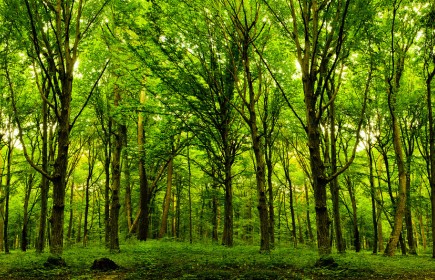
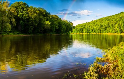
The Open Space and Parkland Preservation Millage was approved by the residents of Ann Arbor in November 2003 as a way to protect productive farmland, prevent the destruction of natural landscapes, and preserve the rural character surrounding Ann Arbor. Commonly known as the Greenbelt Program, the millage provides funds to preserve and protect open space, farmland, natural habitats, and the City’s source waters inside and outside the city limits. More than halfway through the 30-year millage in 2021, the Greenbelt Program consists of over 6,200 acres of protected land on more than 70 parcels. While successful, the program lacks adequate ways to report impact and motivate support beyond acres preserved and funds leveraged. Like many organizations working to protect land, they are in need of additional ways to assess and communicate more meaningful measures of conservation value, such as quantifying ecosystem services.

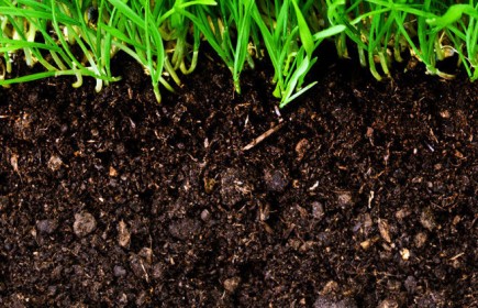
Our goal was to develop a series of dynamic geoprocessing tools to quantify specific ecosystem service value of the Greenbelt’s current portfolio of properties and any new properties added in the future. This will allow the City staff and residents of Ann Arbor to have an ongoing understanding of and ability to communicate the value of individual properties and entire land conservation programs. We focused on two categories of ecosystem services: (1) above and belowground carbon storage and (2) water quality.

Year
2021
Project Status
Past Project
Client Organization
The City of Ann Arbor
Students Involved

Jackie Edinger, Jessica Einck, Sebastian Kasparian, Lavran Pagano

SEAS Faculty Advisor
Sheila Schueller
Shannon Brines
Final Report
2021 Greenbelt Master's Project Final Report
Video
2021 Greenbelt Master's Project Presentation
Specializations
Ecosystem Science and Management
Geospatial Data Sciences

Project Topics

trees
Aboveground Carbon
We used a combination of field-collected and available remote sensing data to develop a model for measuring the amount of carbon stored in trees within forested areas of the Greenbelt. We acquired LiDAR (light detection and ranging) data of Washtenaw County from 2017 to estimate tree height and volume, and we measured tree species and diameter at three sites located in Washtenaw County to estimate tree biomass using allometric equations from the literature. Using these data sources, we compared the effectiveness of various modeling methods to predict biomass across sites. We found that a Power Law model allowed us to best estimate aboveground carbon storage, which we calculated for each parcel in the Greenbelt.
View Chapter
soil
Belowground Carbon
To estimate the amount of carbon stored in the soil of Greenbelt properties we used available spatial data on soil type together with standards from the literature for calculating carbon stored in the organic matter of soils. We used the National Resources Conservation Service (NRCS) Web Soil Survey to determine which soil types are present in the forested and wetland areas of the Greenbelt District and which characteristics, including horizon depth, bulk density, and organic matter content, are known to be associated with these soil types. Transferring these values into ArcGIS Pro allowed us to provide low, medium, and high estimates of carbon storage for each soil type and develop a model to calculate soil carbon stored at an individual property level. Agricultural soils were not included in estimates given that soil carbon would depend highly on specific cultivation practices, which are neither constant nor easy to assess.
View Chapter
river
Water Quality
To evaluate how land protection under the Greenbelt program contributes to water ecosystem services, we compared tools that assess the impact of land conversion on water quality. Based on this review we recommended amendments to existing tools that would improve their applicability to the Greenbelt Program and accessibility for other land conservancies in Southeast Michigan. Specifically, we provided an updated web-based version of the EPA Region 5 Conservation Easement Load Reduction Worksheet and identified the Michigan State University Institute of Water Research’s Great Lakes Watershed Management System (GLWMS) as the optimal tool for future water quality analyses within Washtenaw County. We recommend further collaboration with the Institute of Water Research to expand the spatial scope of its tool to include the Huron River Watershed.
View Chapter
EPA Region 5 Calculator
Great Lakes Watershed Management System

jackie
Jackie Edinger
edingerj@umich.edu

Jackie Edinger is a SEAS Master’s student studying Conservation Ecology and Geospatial Data Science. Originally from Orange County, California, Jackie attended UC Berkeley and graduated in 2018 with a B.S. in Molecular Environmental Biology and minors in Music and Forestry. She has worked as a forestry research technician throughout the Sierra Nevada, focusing on fuel reduction treatments and bark beetle tree mortality in Sequoia and Yosemite National Parks. In her free time, she enjoys hiking, traveling, and playing piano and violin. She is currently a Research Associate on the spatial analysis team at the Colorado Forest Restoration Institute in Fort Collins. 

Jessica Einck
Jessica Einck
jeinck@umich.edu

Jessica Einck is a master's student at the University of Michigan School for Environment and Sustainability studying Conservation Ecology. Originally from Orange County, California, Jessica graduated from the University of San Francisco in 2015 with a B.S. in Biology with an emphasis in Ecology. Before starting at UM, she worked in parks and recreation for three years. In her free time she enjoys spending time outdoors, reading, and discovering new music.

SK
Sebastian Kasparian
sekaspar@umich.edu

Sebastian Kasparian is a master's student at the University Michigan School for Environment and Sustainability studying Geospatial Data Science. His passion lies in using scientific data to better understand, communicate, and mitigate anthropogenic impacts on the environment.

Sebastian has worked for a variety of nonprofit and public entities, from the Huron River Watershed Council in Ann Arbor to the Blue World Institute of Marine Research and Conservation in Croatia. Currently, he serves as a data analyst for the Michigan Department of Environment, Great Lakes, and Energy (EGLE).

LP
Lavran Pagano
lavranp@umich.edu

Lavran Pagano is a SEAS Conservation Ecology and Geospatial Data Science student and is the current remote sensing graduate student instructor at the University of Michigan. He is from the Albany, New York area, and obtained his Bachelor of Science degree in 2018 from Ithaca College in Environmental Science with a minor in Biology.  Lavran is interested in the application of GIS and remote sensing to solve modern-day ecological problems. He enjoys reading, hiking, and attempting to keep his house plants alive.


I'M READY TO APPLYI WANT TO LEARN MORE

seas logo
University of Michigan School for Environment and Sustainability
Dana Building
440 Church Street
Ann Arbor, MI 48109
(734) 764-6453
Email us
facebook
twitter
instagram
linkedin
youtube
flickr
planet blue global impact logo

Footer

  • Contact us
  • Intranet
  • Contact Web Team

© 2023 The Regents of the University of Michigan | Privacy Policy | Diversity, Equity & Inclusion

Produced by Michigan Creative